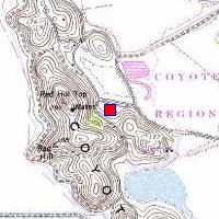
SF-37L Coyote Hills NN 37.55379°, W 122.09089°, elevation 18 feet |

|
SF-37L Coyote Hills NN 37.55379°, W 122.09089°, elevation 18 feet |

|
The launch silos were on the northernmost of the Coyote Hills.
No traces remain - the magazines were collapsed and the hill was re-graded.
The current visitor center for Coyote Hills Regional Park is where
the administration buildings were.
This was also briefly the site of SRI's Bio-Sonar Research Lab.
Access: take Newark Blvd. to Patterson Ranch Road, park at the visitor
center, and you're there.
